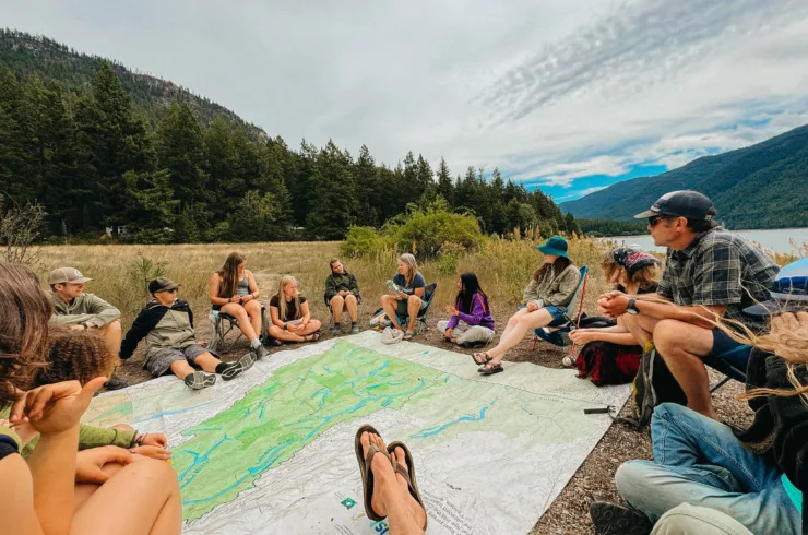
Lake Windermere shoreline management guidelines — ready to roll

A first for the region; a boon for developers, builders and habitat


Windermere Lake’s new Shoreline Management Guidelines are hot off the press.
Or, in this case, hot off the desks of biologists and land managers.


The guidelines are a first for the region. They were created through a new, collaborative approach to shoreline management in B.C. developed by the East Kootenay Integrated Lake Management Partnership (EKILMP). 


“The EKILMP started in 2006 because of concerns people had about the fast pace of shoreline development in the East Kootenay,” said Heather Leschied. Leschied is Wildsight’s Lake Windermere Project program manager and the chair of the EKILMP. “The guidelines have come out of considerable field work, research and consultation.”


Guidelines: WHO, WHAT, WHEN, WHERE and WHY?


Anyone who wants to propose shoreline development will benefit from using the guidelines. This includes land owners, property developers, First Nations groups, consulting firms, industry and government.


“The guidelines are tools,” Leschied said. “Land owners and property developers will find them particularly useful, as will consulting agencies.”


WHAT are the guidelines?


The guidelines strive to balance shoreline development and the protection of fish and wildlife habitat along Lake Windermere’s foreshore.


Development includes things like retaining walls, marinas, boat houses and docks. Habitat includes areas for fish and wildlife.


“These guidelines give a step-by-step process to follow,” Leschied said. “They come with maps, tables, an explanation of the colour zones and a flow chart to use.”


STEP-BY-STEP PROCESS:
Step 1) Use the MAPS to find the COLOUR ZONE that your application is situated in.
Step 2) Use the ACTIVITY RISK TABLE to determine the risk of your activity.
Step 2a) Double-check if a SPECIES AT RISK is identified in the area.
Step 2b) If your activity is HIGH RISK, see if you can move to a less sensitive habitat, or a lower risk activity.
Step 3) Use the FLOW CHART to determine your next steps.


The guidelines deal specifically with the foreshore of Lake Windermere— the space between the high and low water mark.


“Foreshores are biologically rich areas that link aquatic and terrestrial environments. They are sensitive to disturbance,” Leschied said. “Lake Windermere’s foreshore is 36.3 kilometres around and includes diverse areas such as cliffs, low rocky shores, beaches and wetlands.”


More foreshore facts:
• 62% of the foreshore is classified as DISTURBED.
• 24% of the foreshore has been developed for residential use.
• It has 443 retaining walls, 202 docks, 11 marinas and 107 boat launches.
• 20% of the foreshore is classed as a wetland (Lake Windermere is a widening of the Columbia River system and has the Columbia Wetlands to its north and south.)


And a fish fact:
• Lake Windermere has 14 native fish species, such as blue-listed westslope cutthroat trout, and 4 introduced fish species, such as Kokanee.


WHEN do the guidelines take effect?


“The guidelines are effective now,” Leschied said. “We anticipate these guidelines will become part of the Lake Windermere Management Plan currently underway by the Regional District of East Kootenay and the District of Invermere. It is expected to be completed in March 2010.”


WHERE can I find more details?


Check out the guidelines and the reports that led into them:


1) Foreshore Inventory and Mapping (FIM)—in-depth look at the foreshore
2) Fisheries and Wildlife Habitat Assessment—report on habitat
3) Guidance Document—The shoreline management guidelines


Each is available—along with the appropriate maps—HERE.


USE an interactive HABITAT ATLAS


Guidelines are available in hard-copy at:


• District of Invermere Municipal Office: 914, 8th Avenue, Invermere • 250-342-9281
• Ministry of Environment: 205, Industrial Road, Cranbrook • 250-489-8540
• Regional District of East Kootenay, Columbia Valley Sub-Regional Office: 4956 Athalmer, Invermere • 250-342-0063


WHY are the guidelines a good thing?


“The goal is to create a greater level of protection for sensitive zones along the shoreline,” Leschied said. “We have accomplished the means of doing this with the Lake Windermere shoreline management guidelines.”


The guidelines also represent a successful start for the East Kootenay Integrated Lake Management Partnership, whose aim is to “protect lakes by producing ecologically based land use and development guidance documents and encouraging more integrated and coordinated approaches by all levels of government and developers.”


Current members of the partnership include:
    Fisheries and Oceans Canada
    Ministry of Environment
    Regional District of East Kootenay
    District of Invermere
    Integrated Land Management Bureau
    Transport Canada
    Lake Windermere Project (Wildsight)
    Interior Health
    Canadian Columbia River Intertribal Fisheries Commission (CCRIFC), representing the? A’kisq’nuq First Nation, Shuswap Indian Band and Ktunaxa Land and Resource Council
     Wasa Lake Land Improvement District